About Wisconsin Lake Explorer
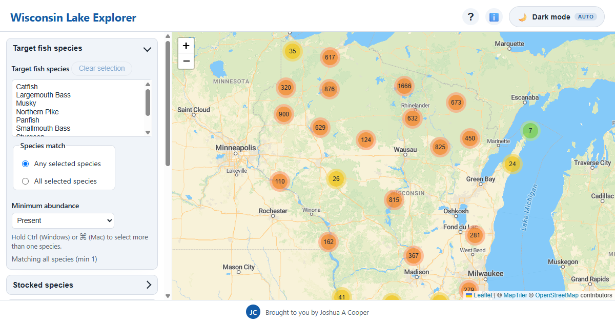
Wisconsin Lake Explorer is a free interactive map for finding your next favorite lake among nearly 10,000 lakes across Wisconsin. Whether you're chasing walleye and musky, looking for a quiet smallmouth bass lake off the beaten path, or planning a family day at a swimming beach, the map lets you filter every documented lake in the state by what actually matters to you.
- 9,924Wisconsin lakes mapped
- 1,693lakes with public boat landings
- 23fish species & groups tracked
- 112lakes with public beaches
Find fishing lakes by species
Filter lakes by the fish that live in them, including walleye, musky (muskellunge), largemouth and smallmouth bass, northern pike, panfish like bluegill and crappie, catfish, trout, and lake sturgeon. Each lake's species list comes with abundance ratings — abundant, common, or present — so you can target waters where your species actually thrives instead of guessing. You can also require a lake to hold all of your selected species, which is how you find those multi-species trips.
Stocking history from the Wisconsin DNR
The map includes fish stocking records, so you can filter for lakes stocked frequently (five or more events in the last ten years), occasionally, rarely, or only historically. Stocking data is a strong signal for trout and walleye fisheries in particular.
Public access: boat landings, parks, and beaches
Nothing ruins a plan like discovering there's no public way onto the water. Wisconsin Lake Explorer marks which lakes have public boat landings, public parks, and public swimming beaches, so you can plan a launch or a beach day with confidence — 1,693 lakes in the dataset have a public landing.
Depth, size, water clarity, and lake type
Filter by lake size in acres, maximum depth, water clarity, and lake type (drainage, seepage, spring, and impoundment). The dataset spans everything from Lake Winnebago — the state's largest inland lake at roughly 132,000 acres — down to small seepage lakes, and includes Wazee Lake, Wisconsin's deepest inland lake at 350 feet.
Where the data comes from
Lake attributes are compiled from Wisconsin Department of Natural Resources lake pages: fish surveys, stocking records, access inventories, and physical lake data. It's assembled here into one searchable map so you don't have to read thousands of individual DNR pages to compare lakes.
Frequently asked questions
- Is Wisconsin Lake Explorer free?
- Yes. The map and all filters are free to use, with no account required.
- How do I find musky or walleye lakes near me?
- Open the map, pick your species under "Target fish species," set a minimum abundance, and zoom to your region. You can also type a natural-language search like "musky lakes with a boat landing."
- Does the map show boat launches?
- Yes — filter by public boat landing to see only lakes with documented public launch access.
- How current is the data?
- Data is compiled from published Wisconsin DNR sources and refreshed as the underlying pages are updated. Always check current DNR regulations for the lake you plan to fish.